Ways of miners and farmers
Information
Level
Medium
Distance
20.00 km
Drop
590 m
Duration
7 h
This circular route can be started in any of the three villages which are virtually all equidistant from one another. It can also be followed in either direction. To avoid steep climbs (and enjoy more downhills) El Masroig village has been chosen as the starting point and the route continues towards Bellmunt. This section is less than 6km and 260 m gradient uphill, a two hour walk without taking into account time for enjoying the scenery from the top of Sarraí mountain for example.
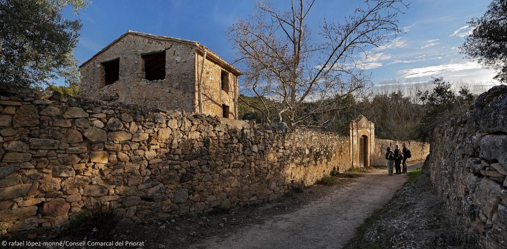
The trail starts besides El Masroig Cooperative winery and continues down Carrer de les Pinyeres (Pinyeres Street) (1) until Barranc de la Vila (village ravine). Here, we take a right turn and continue along the path which follows the ravine upwards (2). The path crosses the ravine on three occasions. Before crossing it for the fourth time, we take a little snicket or ginnel (3) on the left which is parallel to it. We skirt along the edge of a vineyard until we leave it by taking a farm track lined by olive trees which leads us to a farmhouse and from this point we take a smaller path (4) which continues up a steep bank until it joins a footpath. Continue along this footpath very close to a pylon (electric) (5) and continue to the left. The path continues until it almost reaches the top of the Sarraí mountain (6) and then descends until it joins a farm track (7) which leads to a crossroads (8). Turn right and you will reach the Museu de les Mines de Bellmunt (Bellmunt Lead Mine and Museum) (9).
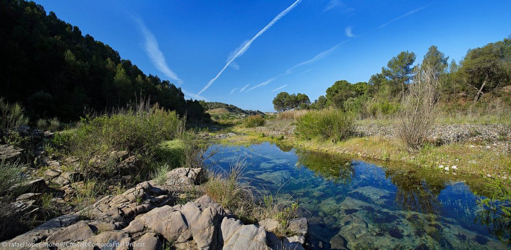
From Bellmunt to El Molar, the trail is less than 8km and 170m gradient uphill which takes less than 3 hours to walk. Return back the way you have come until the last crossroad (8) and continue on the main track. This track leaves the wood and descends through vineyards and olive groves. On the left, a former bridle path drops down to the dry river bed (10), ascends a small hill and then drops down again to reach the old cart track (11). This track leads to the prehistoric settlement of Puig Roig del Roget (13).
Near to the settlement (12) you will take a path which descends towards the river until it reaches a fruit tree plantation. You can turn left here (14) and cross the river at the river-crossing a little further on or turn right and cross the river using stepping stones (15). In both cases, you will reach the paved road near to De Muller winery (16). From here, you cross the road and continue along the dirt path which leads through vineyards towards the mountains. You will pass by a fork in the path leading off right (17). Continue straight on towards the wood. The path veers left and continues to ascend. You pass by a water tank for fire extinction on your right (18) and you will reach the flat plains at the top. Leave the path which leads off to the left and continue straight on between vineyards and olive groves. After this, you will reach the ruins of the Mas de la Nadala (Nadala Farmhouse) (19). The path descends here and on the left, joins the narrow path which becomes the former bridle path. The path crosses the dry river bed and continues uphill and comes out at Rocalda (20) near the village.
It will take 6km and a 160m gradient uphill and about two hours of hiking from El Molar to El Masroig. From Rocalda (20), you descend to the left and take the concrete cart track until you reach the road (21).This is where the old way from El Masroig begins and passes through olive groves and vineyards. Further on, you leave the old way near a winery building (22) and you take a left turn (23) climbing slightly before descending to the river along the farm track. Once at the river, you will be close to the old Moli del Coco (Coco’s Mill). You will need to find the best spot to ford Siurana River here.
On the other side of the river, you will find the old bridle way (24). Continue along the wide cart track (25) which takes you through vineyards. This track skirts around the little hill. Keeping the uncultivated land always to your right, leave the more beaten track to your right and take the path which climbs upwards (26). As you almost reach the top, do not take the path which leads off to the left, but continue straight on until you reach the bridle way again. Leave this on a cart track which runs along the mountain ridge (27) and continue right towards El Masroig. Further on you will reach a fork in the trail (28). Both tracks lead you within sight of El Masroig, as you continue through cultivated land.
Image gallery